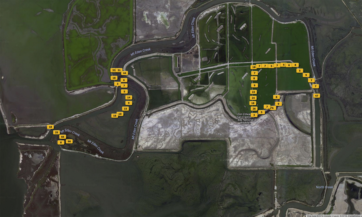
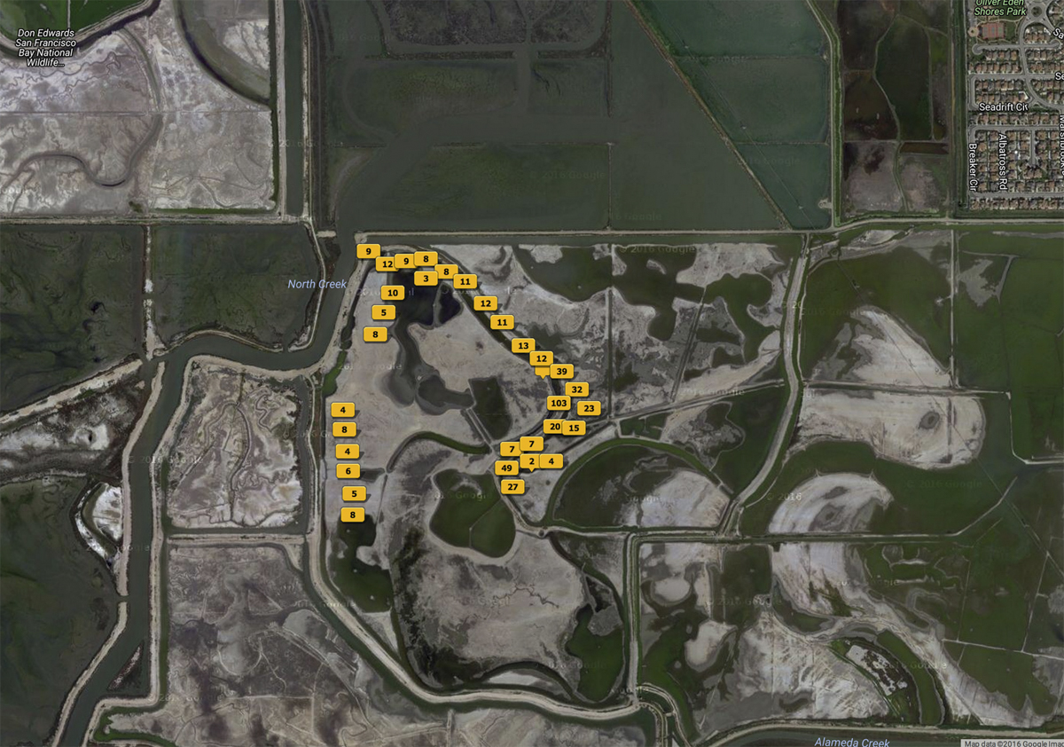
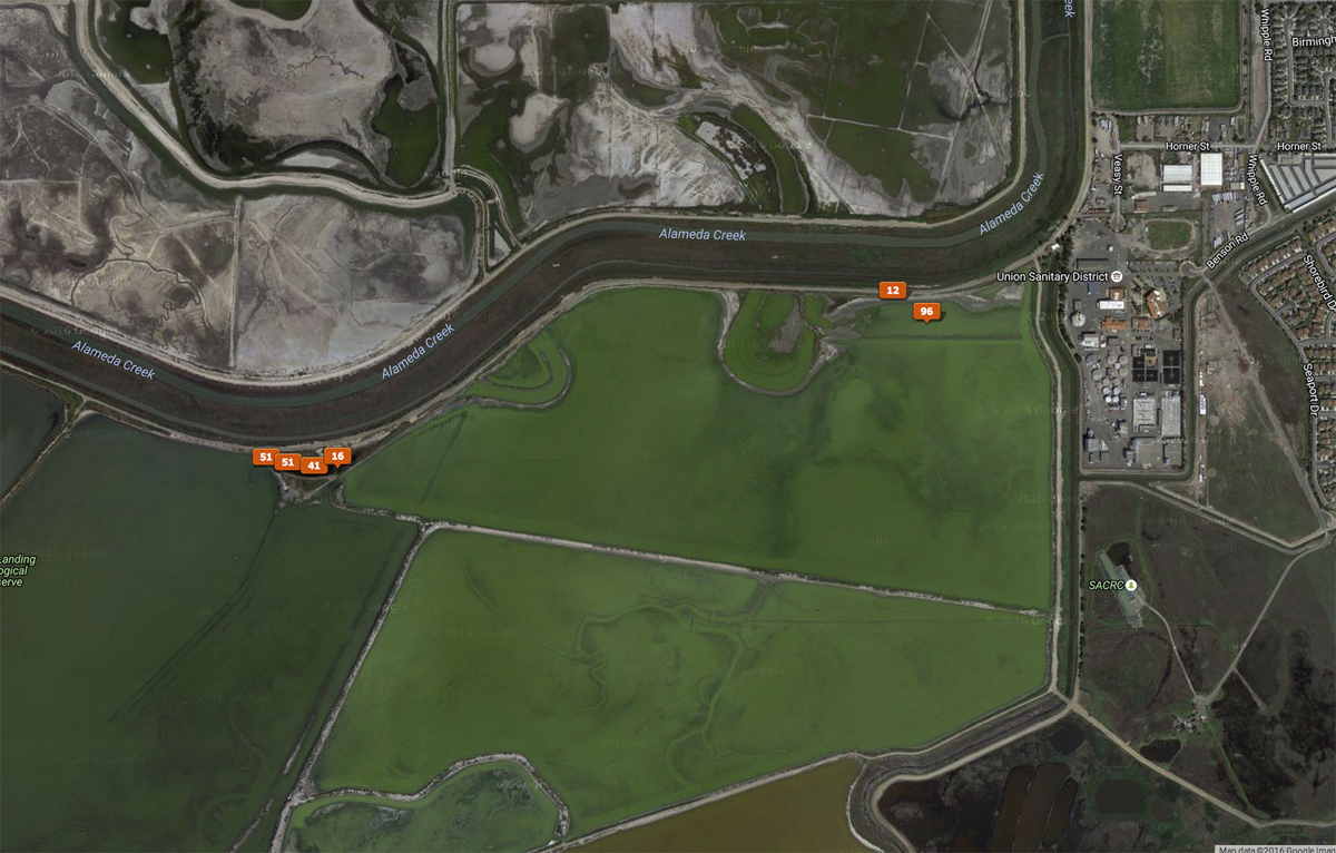
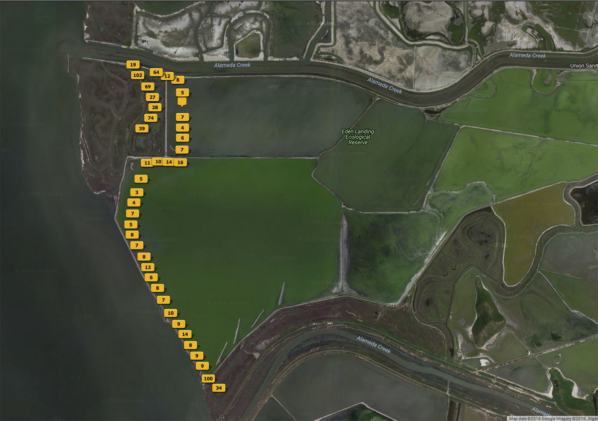
2012 - 2015 KAP Sessions in South San Francisco Bay
PROGRESS REPORT: Kite Aerial Photographs from the Hidden Ecologies Project
Cris Benton
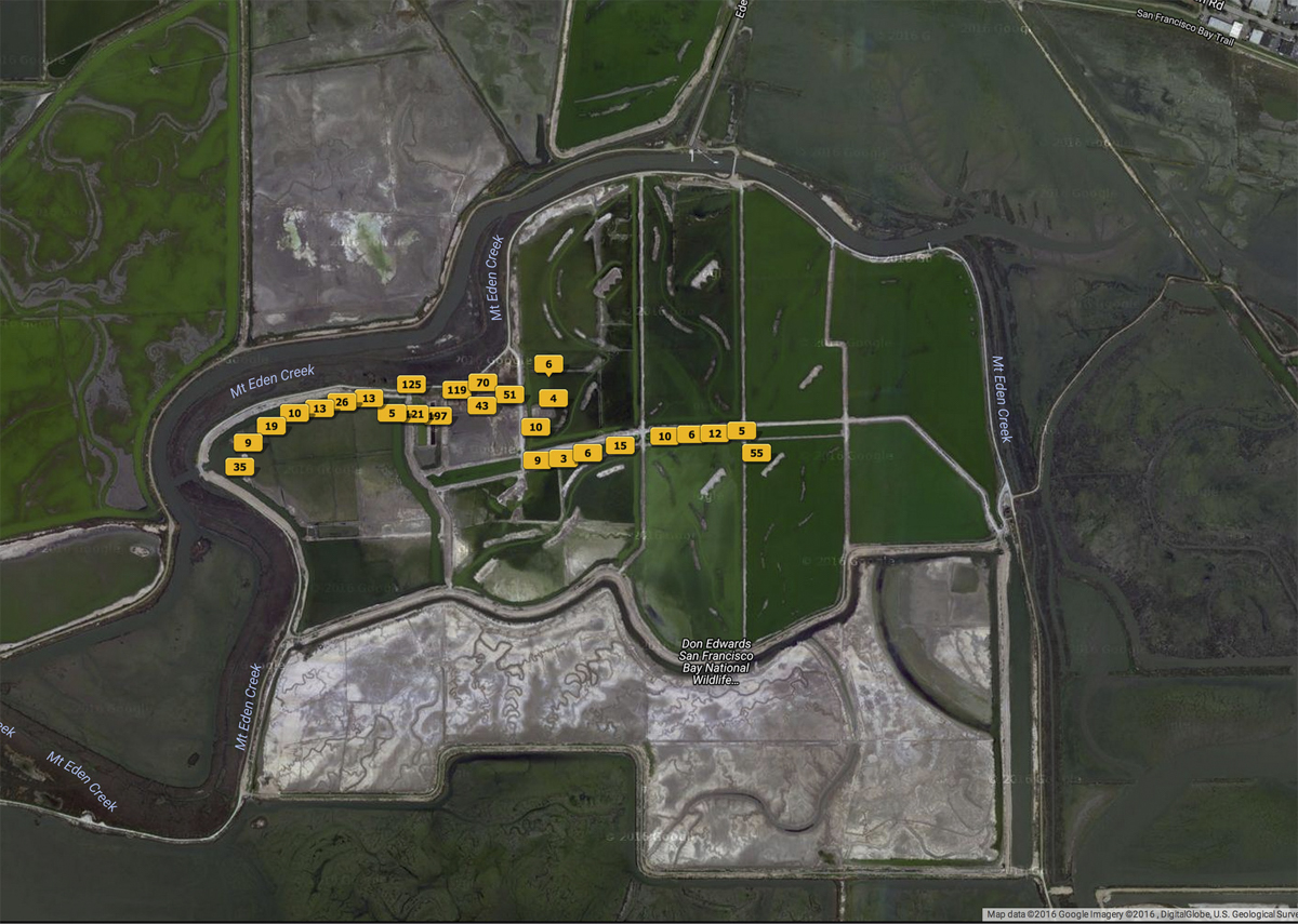
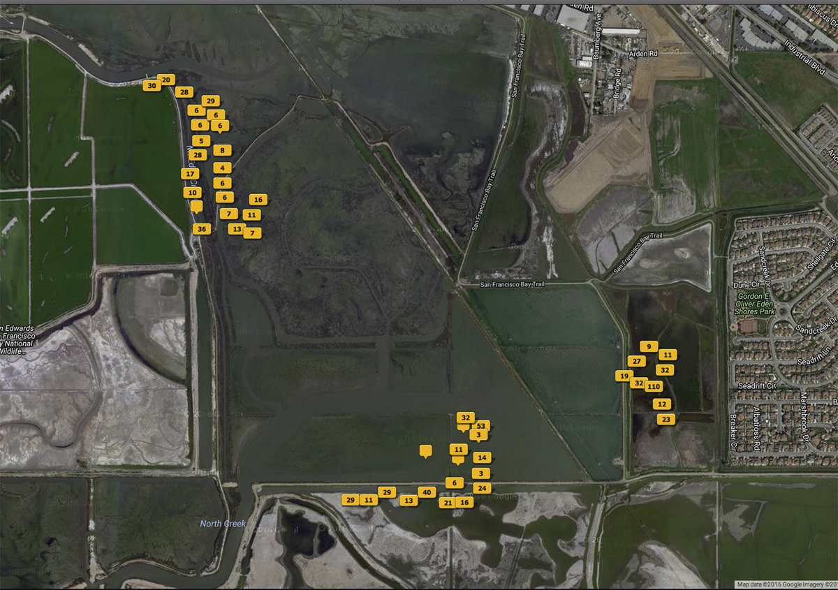
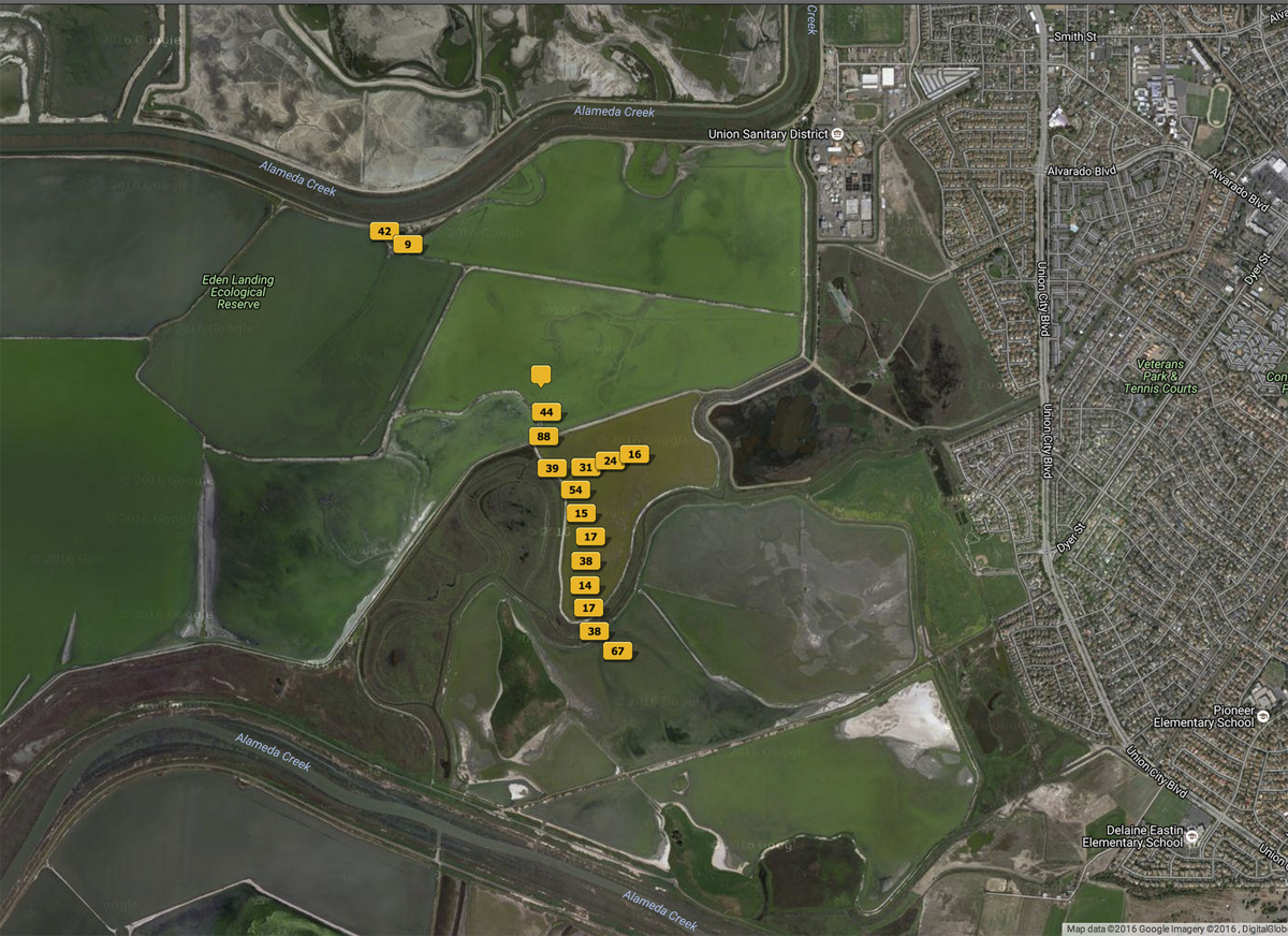
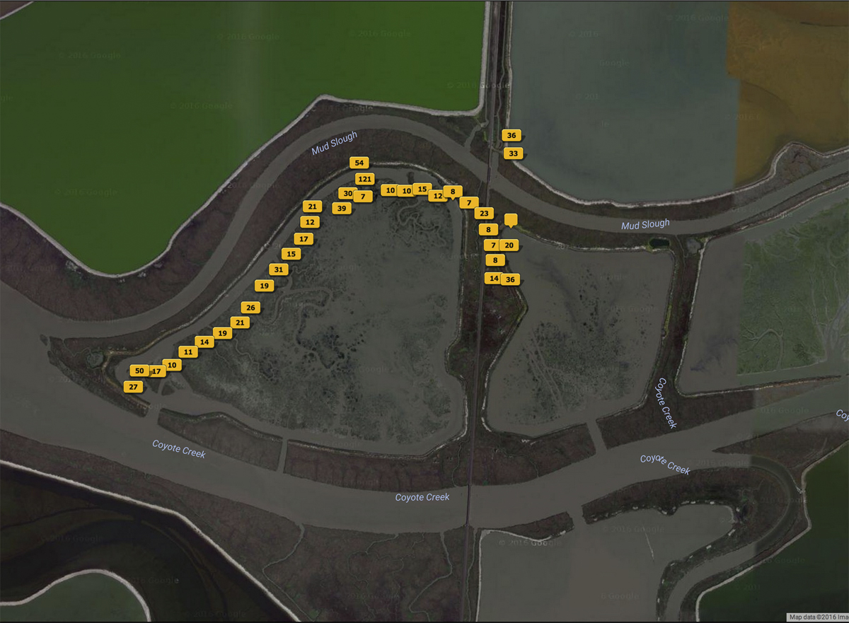
I have been fortunate to receive permits from U. S. Fish & Wildlife and California Fish & Wildlife granting permission to take aerial photographs over the South Bay landscape. As part of a periodic cycle of permitting, I submit progress reports on the Hidden Ecologies Project and a summary of photographs taken. The last three years were a period of moderate activity – 40 trips to the South Bay Salt Pond Restoration sites and adjacent areas. Thirty two of these trips involved KAP sessions with the total for the year of ~18,400 aerial images. These activities as well as efforts in dissemination are summarized in the progress report and in my KAP Supplemental CV.
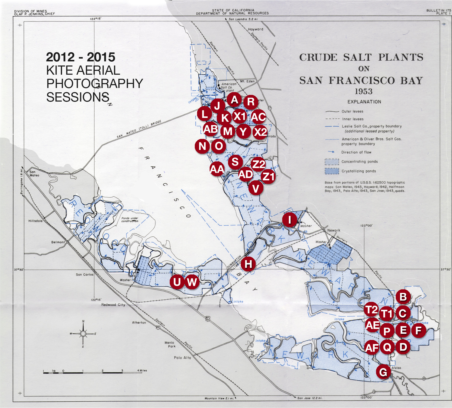
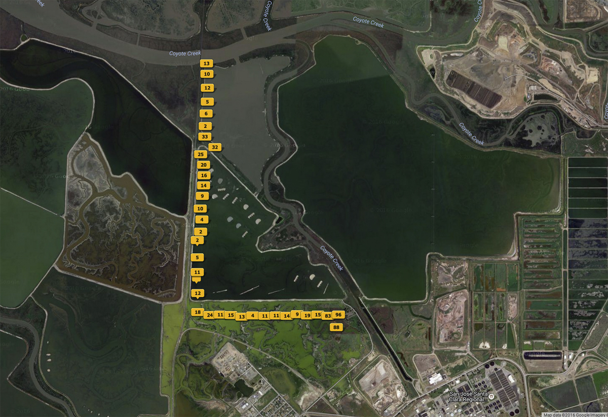
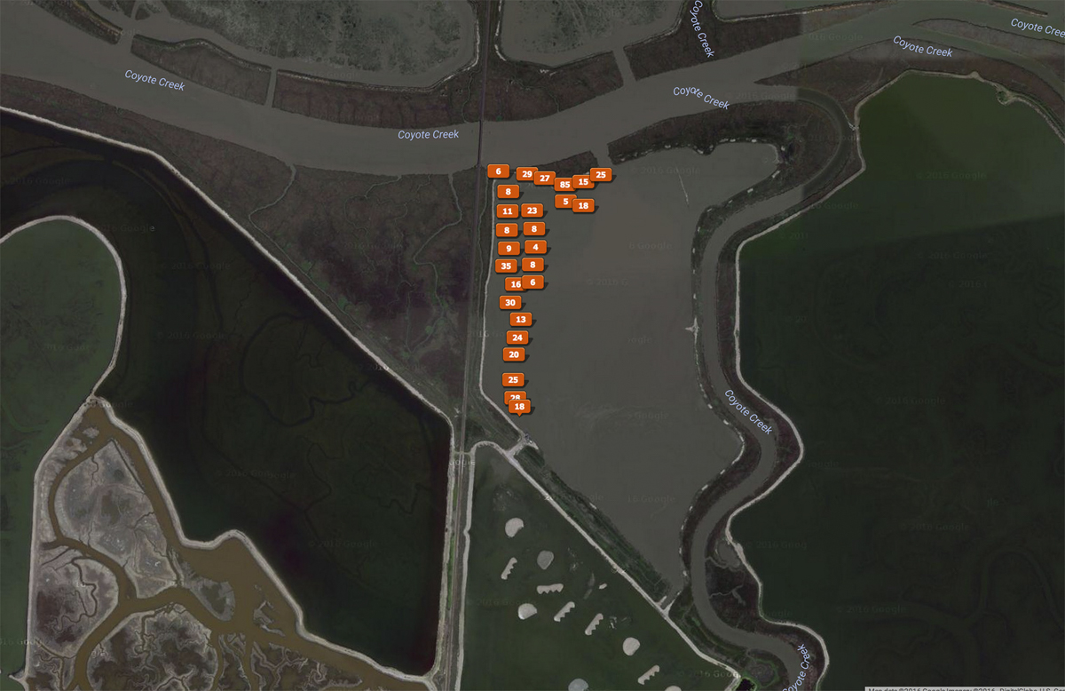
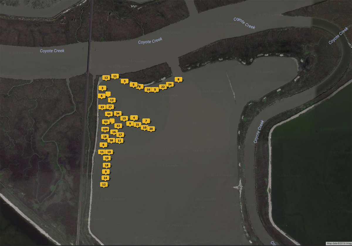
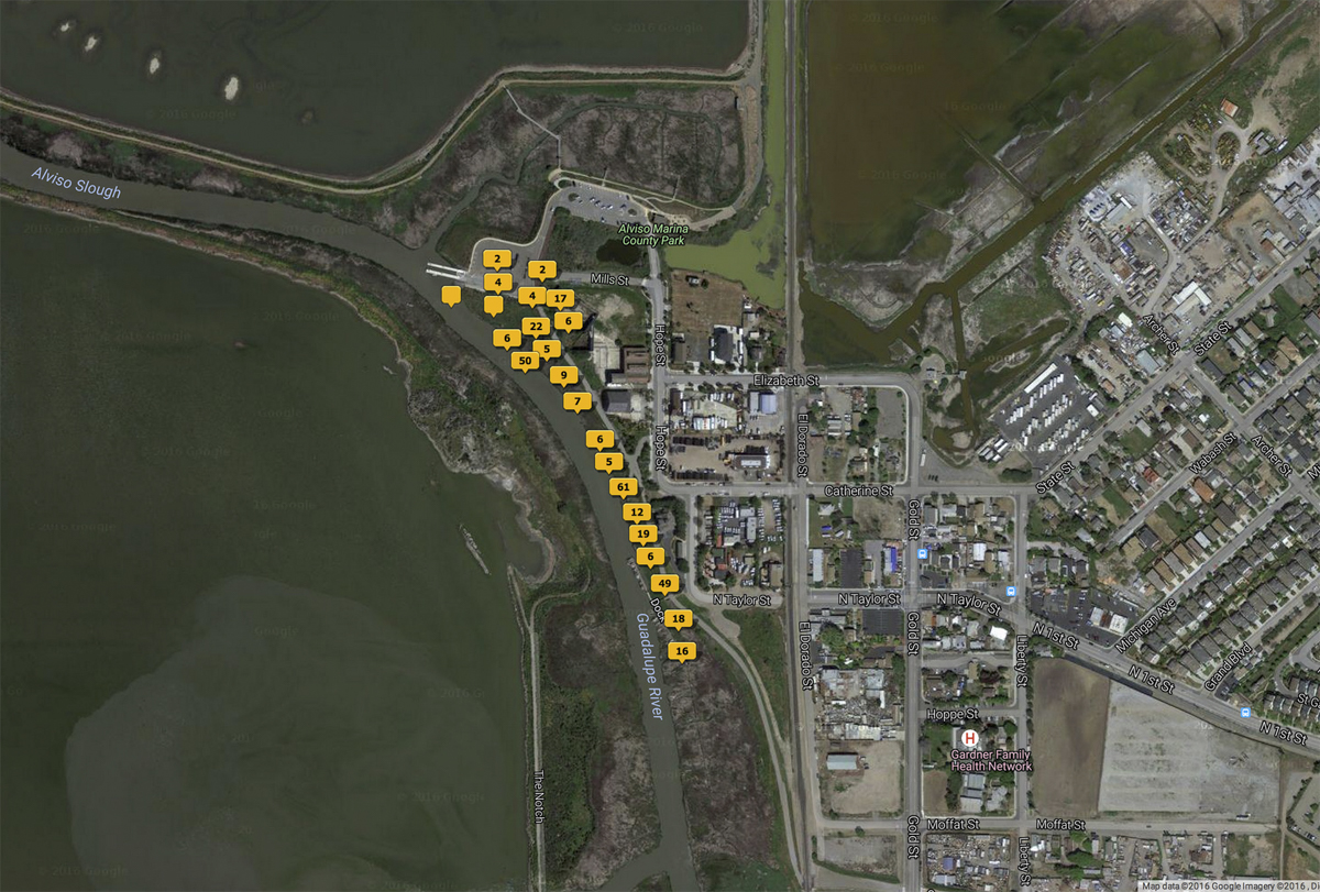
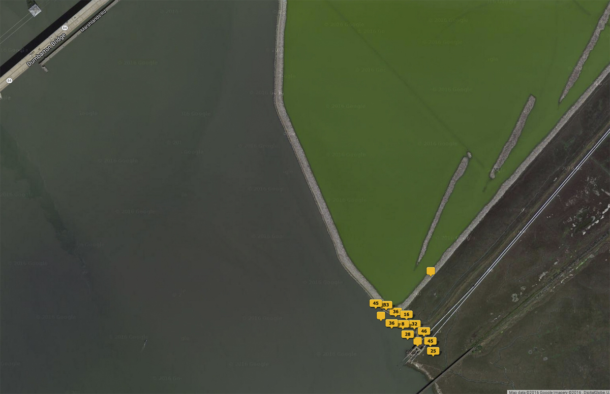
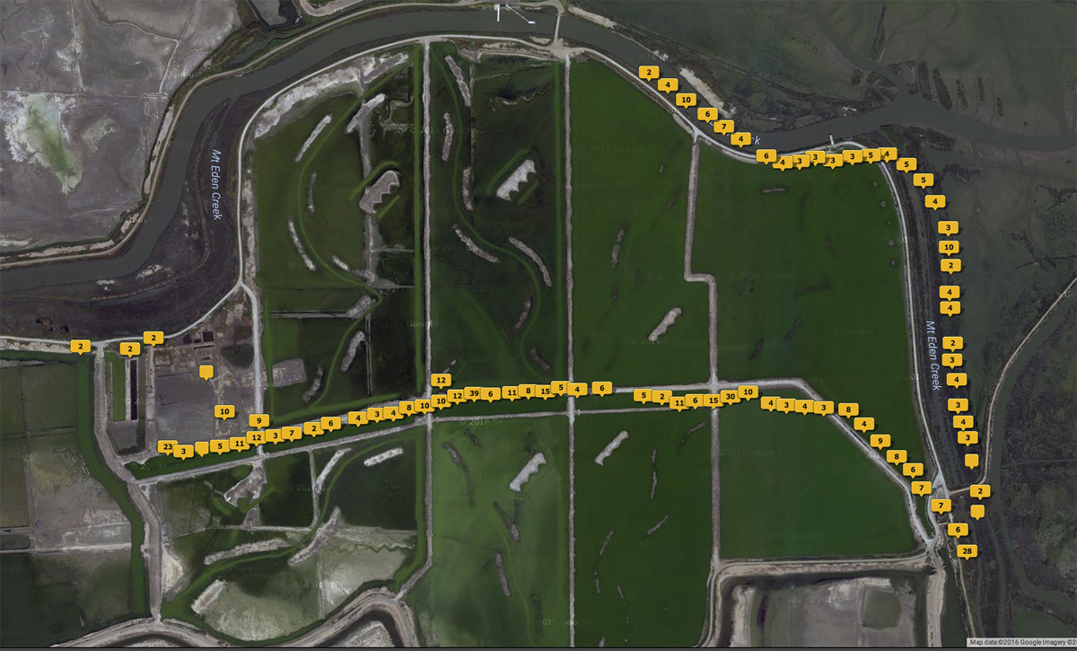
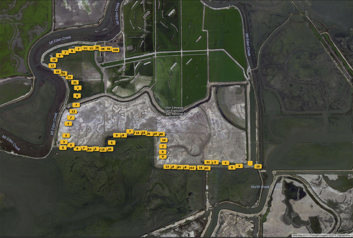
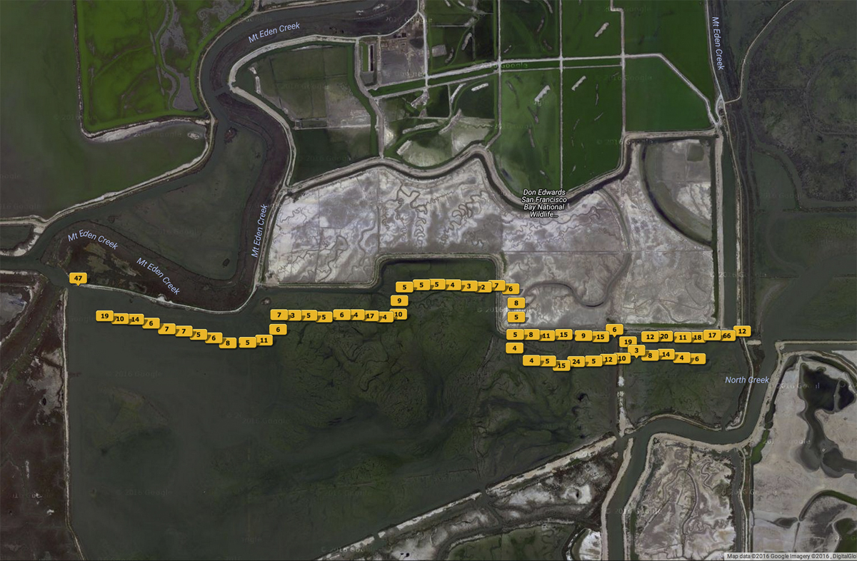
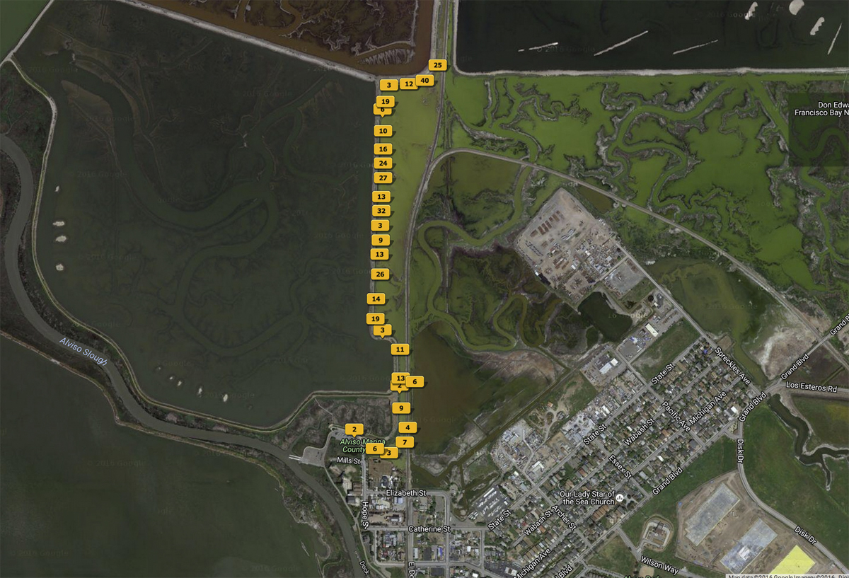
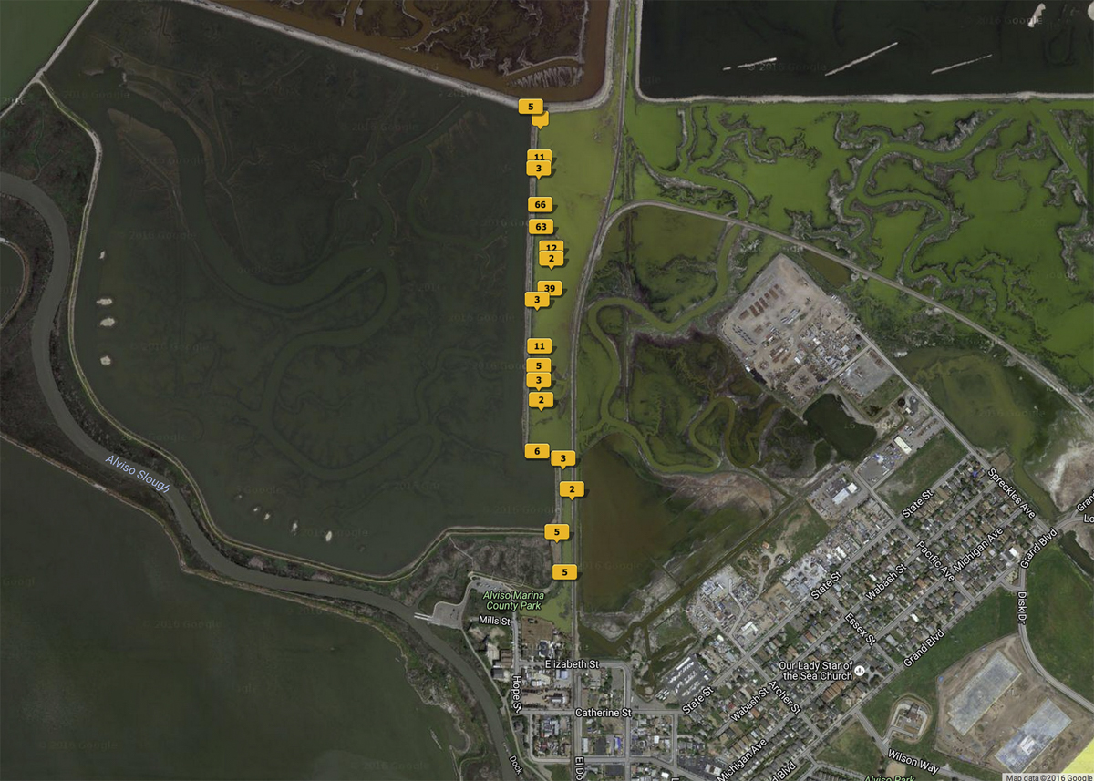
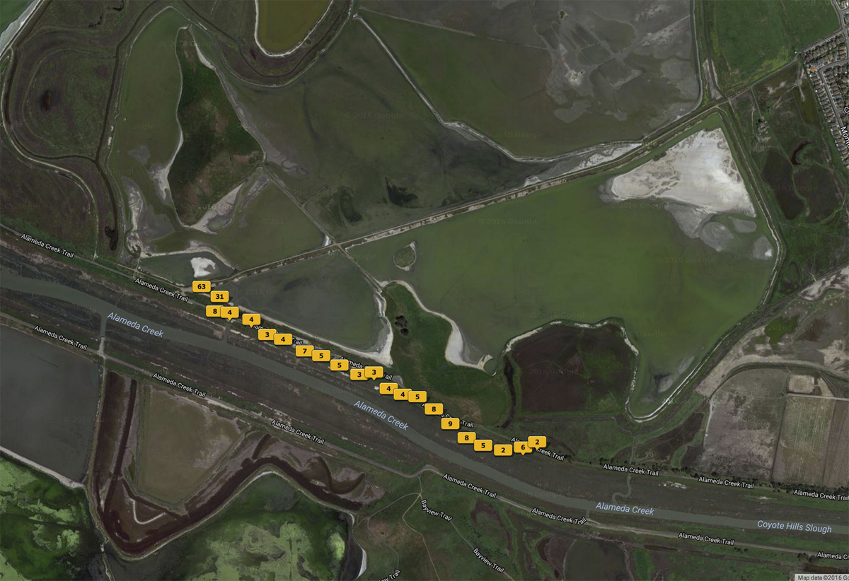
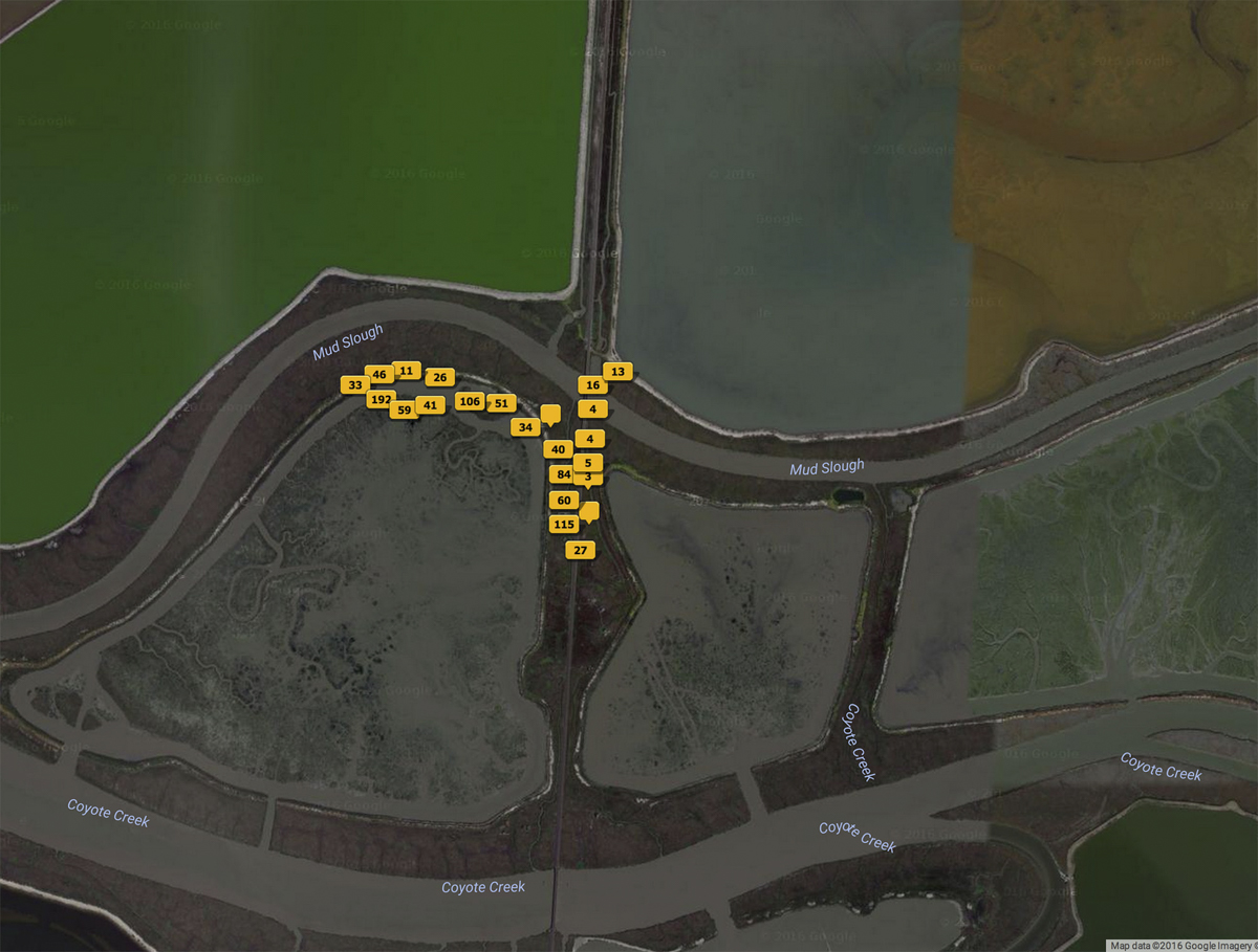
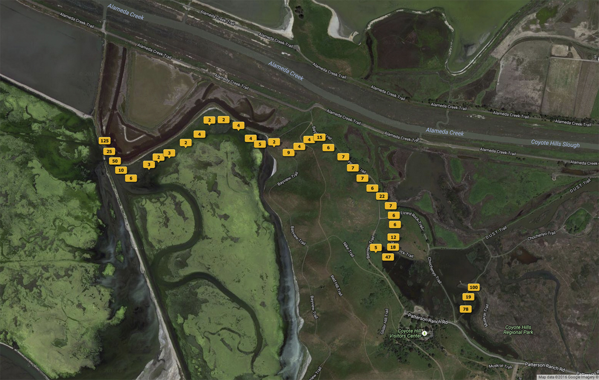
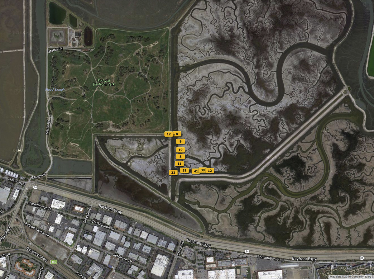
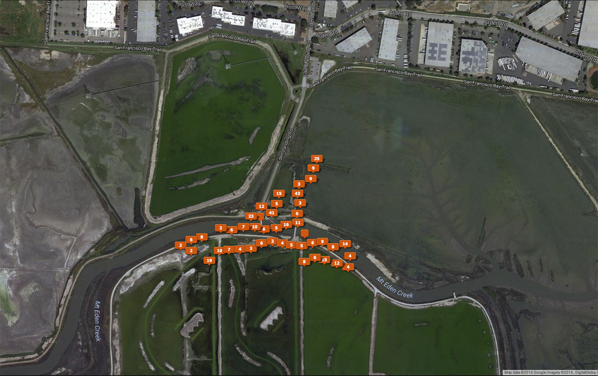
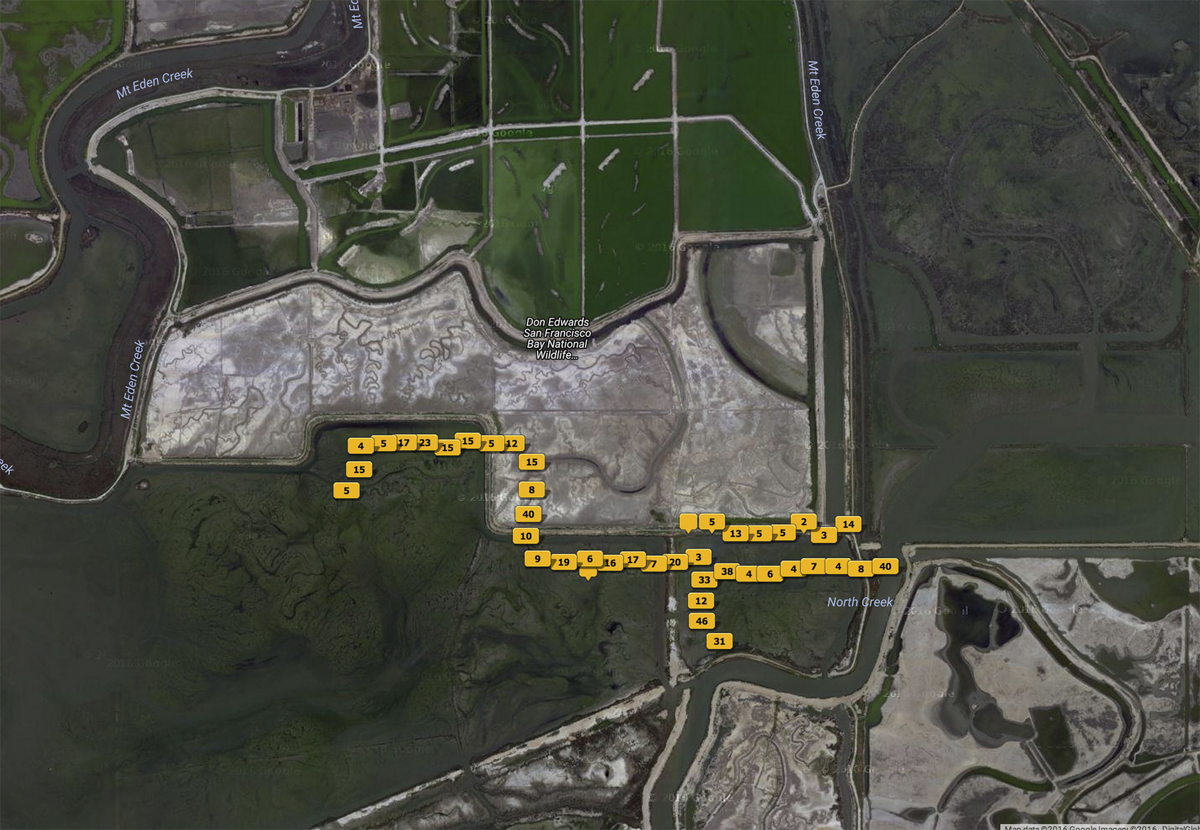
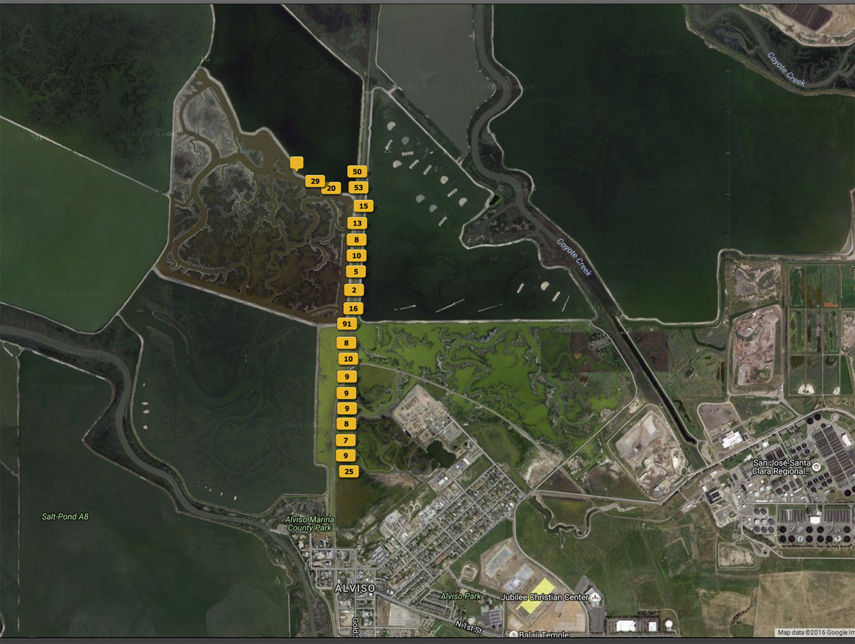
The symbols on this map of the 2012-2015 aerial photo sessions are links that lead to a sample gallery from each session.
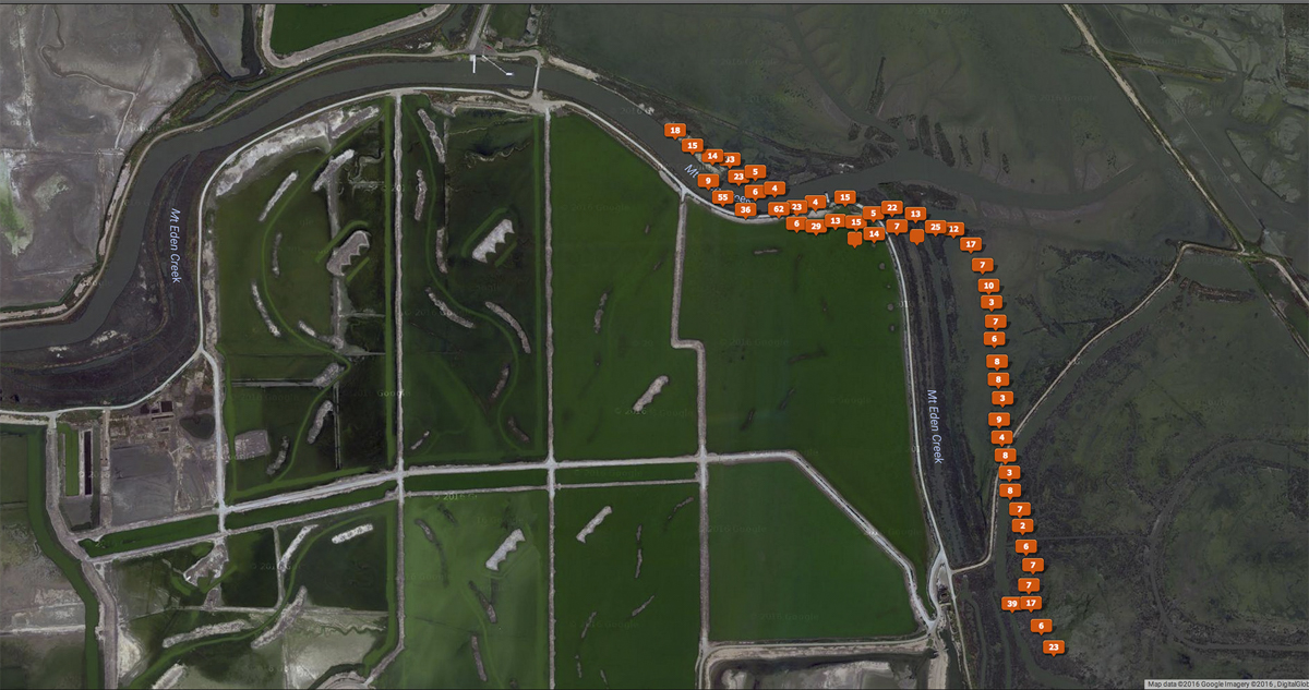
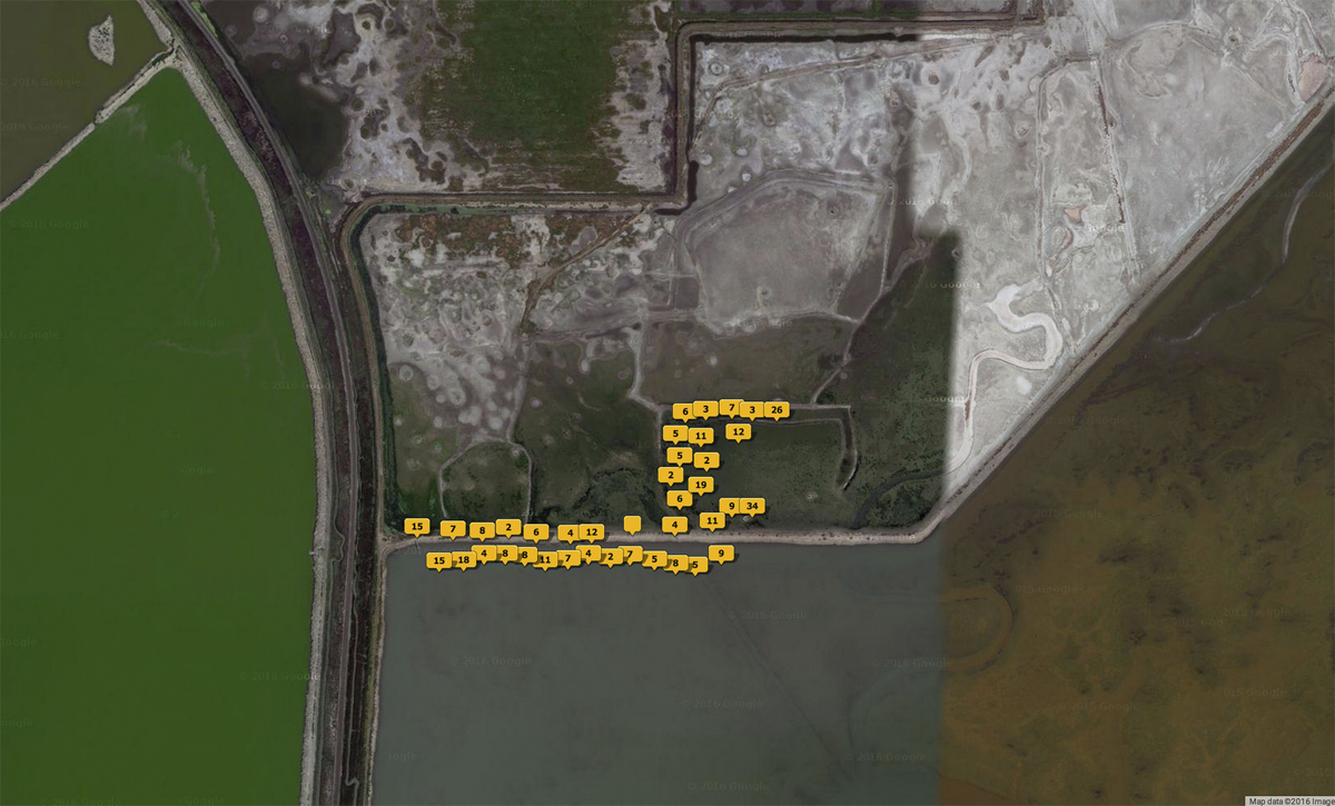
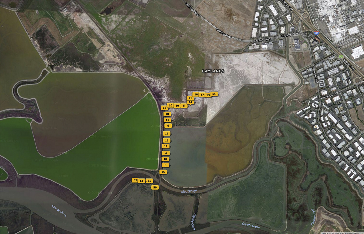
If you prefer a table here is a chronological listing of sessions with links for the gallery pages and "maps" showing the GPS locations of images from each session. In general, the last image in each gallery set is the GPS map.
Images from the South Bay Salt Pond Restoration Project (#SUP 81640-2012-036, 81640-2013-033)